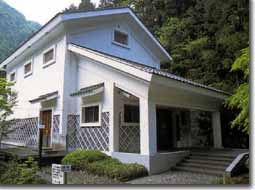
Hayakawa Branch Office
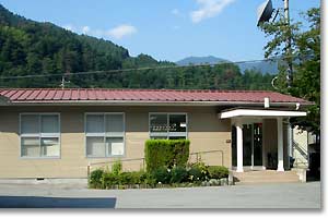
Hayakawa Branch Office
The task of Hayakawa Branch Office
So far, river flooding under heavy rain, such as typhoons in 1959, washed out our home land and caused large damages over our living. The Hayakawa Branch Office is making hard efforts to maintain the safety of the lower alluvial fan area by constructing Sabo dams and channel work facilities at the heavily devastated area along Haya river. By 2001, the Fujikawa River Basin Sabo Office will complete 188 Sabo dams, 38,558m of river bank works, 220 groundsill works, and 15.26ha of landslide protection works, also construct facilities which concern for harmonizing the nature and human.
1227, Ho, Hayakawa-Cho, Minamikoma-gun, Yamanashi, 409-2713, Japan
Hayakawa basin
| Catchment area | 509.1km2 |
| Watercourse length | 73.9km2 |
| Specific height | 2,183m |
| Average river slope | 1/25 |
| Highest point / Mt. Kitadake | 3,192m |
Characteristics of the Haya river basin
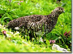
The Haya river basin is located at the west side of Itoigawa-Shizuoka Tectonic Line, which is the west edge of the Fossa Magna where the Japan Islands is divided into the north-east and south-west parts. The soil of this area is very fragile and often causes the sediment-related disasters. On the other hands, this is a very good habitat for animal and plant species, including national specialized Japanese antelopes, snow grouses, and ayu fishes.
Mountains with abundant nature. Miserable massive collapse on Mt. Shichimenzan!
The Fuji river system carries out a huge amount of soil from the river banks and riverbeds because of fast flow along steep slopes. Due to the giant fault, Itoigawa-Shizuoka Tectonic Line (Fossa Magna) runs under the central area, it has fragile soil that causes land slide and debris flows. There are many large collapsing sites spreads over the area, such as on the slope of Mt. Shichimenzan.
Haya River Basin Subo Map
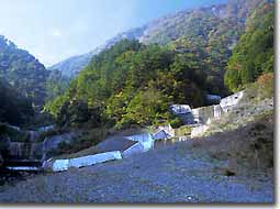
53.Arakawa No.2 Sabo dam
 An arch type Sabo dam seemed to be suitable at the Arakawa No.2 Sabo dam because of bedrock nature. An uni-center semi-arch Sabo dam was constructed. The height is 30m (8m at the foundation), it is the second largest to Inamata No.3 Sabo dam. The length expands to 77.7m
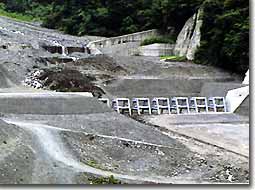
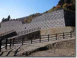
75.Inamata No.3 Sabo dam
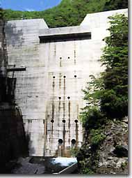 Because of the Sabo dam basic style is gravity type, the width is as large as 52.95m. Also, the height is as high as 50m and the sediment trap capacity is 1,273,000m3. This is the largest Sabo dam inside the Fujikawa Sabo Office District.
77.Hayakawa Ojiro upstream Sabo dam group
 Along Ojiro river which originates from Mt.Ooganeyama, Hayakawa town, these Sabo dams are located above the Hayakawa Ojiro No.4 Sabo dam. The construction was stared in 1988, and total of 7 Sabo dams have been completed in Sep., 2001.
84.Oikenosawa Sabo dam group
 Because of a stream with frequent debris flows, an open type, which has less steel pipe quantity than cubic lattice Sabo dam, B type slit was selected. This is also one of the longest Sabo dam in the Fujikawa River Sabo Office Districe, the length is 200m.
86.Hirogawara No.2 Sabo dam
 This Sabo dam is located at middle reach of Noro river, which originates from Mt. Ainodake (3,189m). The height is 14m, and the length reaches to 143m.
88.Hajikajima Sabo dam
 Hajikajima river has a very steep gradient, its banks form a V shape valley consists of steep slope or cliffs. The river width is very narrow. The main Sabo dam of 55m long, counter Sabo dam, and channel work are constructed.
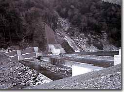
93.Gozengaresawa Sabo dam group
 The sediment control facilities for the Gozengaresawa River, which has a slope failure at its top section, and the Shimonishinomiyasawa River, which is a debris flow hazardous river I, consist of four sabo dams, hillside works and small check dams. We aimed to control these by merging both rivers together at the end of their flows.
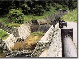
94.Norogawa No.2 Sabo dam
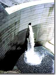
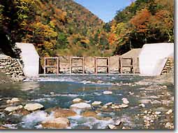 To increase the slit area for longer unload capacity, a steel piped slit type was selected. Regarding environmental concern, the notch was constructed on the concrete foundation for fish migration.
Hayakawa Ashiyasu Basin Guide Map
Noro river and Haya rivers which originate from the South Alps mountains flow down in the 2 municipal areas with beautiful nature, Hayakawa town and Ashiyasu Minami-Alps City.
Hayakawa town offers interesting cultural facilities harmonizing the affluent nature and fresh environment including historical Nishiyama hot springs and Narada in deep mountain area. On the other hand, Ashiyasu Minami-Alps City has mountain climbing routes to the South Alps and Shirane-san-zan including the Japanese 2nd highest peak, Mt. Kitadake. The majestic scenes over the peaks give breathtaking moments to climbers and visitors. Here are introducing the good sightseeing spots along Haya river in the South Alps.
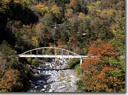
Arakura Fault
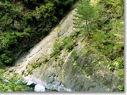 The collapse at the merge area of Haya river and Uchikouchi rivers is the exposed fault of Itoigawa-Shizuoka Tectonic Line (Fossa Magna) which runs under the central Japan. This is a typical reverse fault which approximately 60 million years old Shimanto strata run over approximately 25 million years old Misaka strata. It is specified as a natural monument.
Municipal Yamame Pier
 It is located near the Hokawa hot spring. Enjoy Yamame, a kind of trout, fishing at the pond.
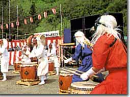
South Alps Hakuho Taiko
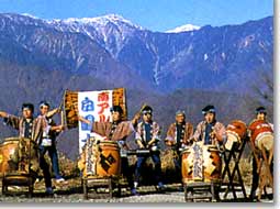 Hakuho Taiko is a dram music with a long tradition and a symbol represents the large scale sceneries in the South Alps.
Various mountain climbing routes
 It offers approximately 6 hours of climbing time from Hirogawara to Mt. Kitadake peak.
About 600,000 climbers visit every year.
Nishiyama Hot Spring and Narada Hot Spring
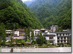 There are hot springs at the deep mountain in the South Alps has 1300 years of history. The tradition continue to the present days. There are various hot springs along Haya river.
Amahata Lake
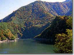 This is a very mysterious lake. There are Villa Amahata for hot spring accommodation and camping site.
Bird Park
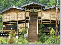 There are various wild birds in beech tree forest, near streams and pond. Bird watching is available from the observation house.
Mt. Ainodake
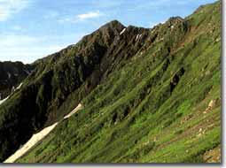 Mt. Ainodake and Mt. Notoridake are over 3,000m peaks and symbols of Hayakawa town.
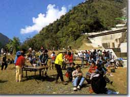
Mountain Vegetable Festival
 This is a big event of vegetable and natural foods for communication among people in local and city.
Koyo Festival in Ashiyasu Minami-Alps City
 Koyo Festival is held at Hirogawara every mid October. There are many events planned enjoying various color changed leaves over trees.
History and Folk Customs Museum (Shiro Shirahata Mountain Photograph Museum)
 This is a museum displays mainly about agriculture with burning field. There are many national specified important cultural properties. At same time, photographs of the South Alps by a famous photographer in Yamanashi are displayed.
Kenjin Waterfall
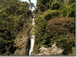 This is a beautiful waterfall at Amahata river with 42m of vertical drop.
Shiraito Waterfall and Statue of Mrs. Oman no kata
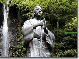 The wife of the Lord Ieyasu Tokugawa founded the Mt. Shichimenzan for spiritual training, where used to be closed to women.
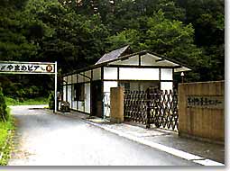
South Alps Plaza
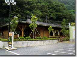 This is the information center and communication place for visitors offers enjoyable activity information in Hayakawa town.
Rich nature at the Hayakawa and Ashiyasu
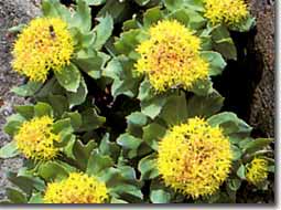
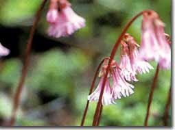
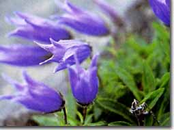
alpine plants
Wild Bird