Hakusyu Branch Office
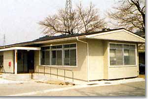
Hakusyu Branch Office
Outline of Hakusyu Branch Office
After the typhoon disaster damaged Yamanashi area in 1959,the Ohmukawa dam construction was started by Yamanashi prefecture government in 1959 and continued under direct management of the Ministry of Construction in 1960.
The Hakushu branch office, which was established on April 1, 1961, has been managing to prepare the sabo dams, groundsills, and channel works around the heavily devastated area at Nagare,Nigori(name was changed to Jingu in 1972), Ojira, Ohmu, and Komu rivers.
By these preparation, the local development was also promoted.
From now on, we will construct a new future for the local area by harmonizing with the nature and mankind.
2310-13,Daigahara,Hakusyu-cho, hokuto-shi,yamanashi,408-0312,Japan
Characteristics of the Five-rivers(Nagare, Jingu, Ojira, Ohmu, Komu)
The Five-rivers are all originated from the over 2,000m peaks. As these average riverbed slopes are as steep as 1/5~1/8, the fast flow is washing away a huge amount of soil from the riverbeds and banks. Also, the area is geologically very fragile and there are large collapses at various locations because the Itoigawa-Shizuoka Tectonic Line runs under the central area. Thus, there were many disasters occurred around the river area. This is a one severe feature where the seasonal changing beautiful nature around the Five-rivers in the South Alps that offers a good habitat for plants and animals.
History of the regional construction in Hakushu Branch Office
| YEAR | DATA |
| 1882 | Mr. Murudoru, engineer in the Interior Office, explains the necessity of erosion control project. |
| 1883 | Erosion control construction at Komukawa, Midaigawa, Oyanagawa, and Hayakawa Rivers comes under direct control of Interior Office. |
| 1959 | Fuji River devastated by Typhoon 7 & 15. Yamanashi Prefecture begins construction work on Ohmukawa sabo dam. |
| 1960 | Fuji River erosion control construction Office established. Ohmukawa sabo dam under direct control of Fuji Office. |
| 1961 | Hakushu Branch Office established. Ohmukawa sabo dam completed. |
| 1982 | Fuji River Basin experiences erosion & landslides as a result of Typhoons 10 & 18. |
| 1987 | Ohtansawa No.2 sabo dam ( Steel lattice frame ) completed. |
| 1993 | Jingugawa No.3 sabo dam completed. |
| 1997 | Ishiutorogawa No.6 sabo dam completed. |
| 2003 | Ojiragawa downstream No.2 sabo dam completed. |
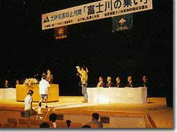
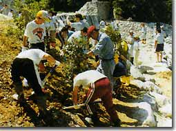
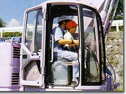
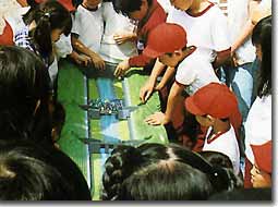
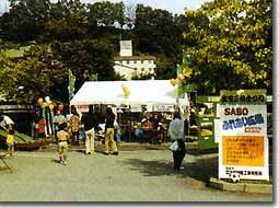
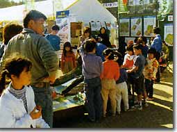
Promotion activity related to the sabo work
The Fujikawa River Basin Sabo Office is now making a good effort to promote the good understanding of the sabo work which protects the people and properties in the local area from the flood and debris flow disasters, at various opportunities.
| Meeting of Fuji river. | Tree plantation ceremony by the elementary school students at the Ojiragawa Karyu Sabo dam completion. |
 |
 |
| was held in Nirasaki shi in 1997 | Ojiragawa, Hakushu cho, Hokuto shi |
| Sabo Outdoor School. Construction machine riding experience | Sabo Outdoor school. Debris flow experiment |
 |
 |
| Ohmukawa Ground-sill, Mukawa-cho Hokuto shi | Ohmukawa Ground-sill, Mukawa-cho, Hokuto shi |
| Sabo Fureai Field during the Takeda three lords festival. | Sabo Fureai Field during the Hakushu country Meisui festival. |
 |
 |
| Nirasaki shi | Hakushu-cho, Hokuto shi |
Hakushu Branch Office District Area Map
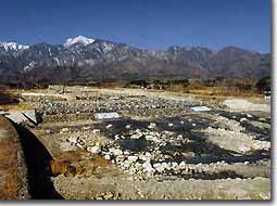
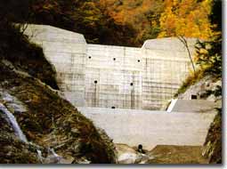
24.Ohmukawa Sabo dam
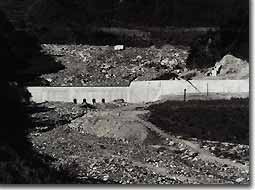 This sabo dam was constructed as a special emergency sabo work after the disaster in 1959.
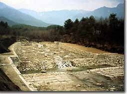
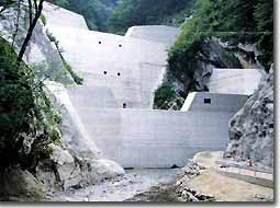
34.Ojiragawa Karyu Sabo dam
 The renovating work for reinforcement and anti-earthquake feature was performed to the dam completed in 1963. A good accessibility to the river was also concerned during renovation of the sabo dam.
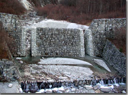
36.Komukawa No.1 Sabo dam
 The large underdrain sabo dam was constructed after the disaster in 1959. The dam well displayed the sediment control effect during the heavy rain in 1982.
51.Nigorigawa channel work
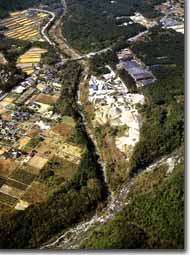 Around 1968, the video camera was used for cost reduction to direct the construction.
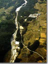
92.Nagaregawa channel work
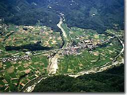 Sky view picture of the 2.0km long Nagaregawa channel work.
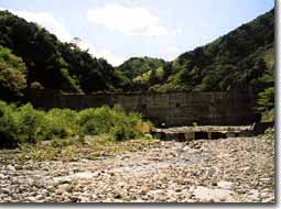
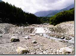
103.Ohmukawa groundsills
 Concerning the natural environment, the various fishways, the Friend Park Mukawa, and Fugen were constructed harmonizing with the local develop-ment plan.
103.Ohmukawa groundsills(Ishiutorogawa)
 There is a good sightseeing area, Shojigataki waterfall, at the upstream. The facility was constructed with a good balance among the nature where king-fishers reside near the banks.
106.Ojiragawa groundsills
 This groundsill was constructed between the merge point with Kamanashi river and the Ojiragawa Karyu sabo dam. The lower stream side was done by the Yamanashi prefecture, and the upper stream side was done by the Ministry of Land, Infrastructure and Transport.
157.Ohtanasawa No.2 Sabo dam
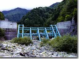 This is the first steel-pipe gridded sabo dam in the Kanto Regional Develop-ment Bureau.
170.Jingugawa No.3 Sabo dam
 The sabo dam is presently located at the most upstream area.
195.Shinosawa No.3 Sabo dam
 This is the large size sabo dam with most vertical height in the Hakushu Branch Office area.
213.Ishiutorogawa No.6 Sabo dam
 This sabo dam has actual river stones on the structure surface for environ-mental concerns.
215.Aoki groundsills
 This facility is being prepared and planned by utilizing the locally found stones as the formwork for cost reduction as well as for local environ-ment concerns.
Unspoiled nature and beautiful scenes in the South Alps
The Five-rivers, originated from the South Alps, run through Hokuto shi, and the northwest part of Nirasaki shi. The snow covered mountains, clear streams and waterfalls, historical shrines and streets...
Introducing country side scenes and sight spots along the rivers.
Houou-sanzan
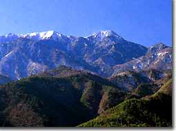 This is a name for three peaks, Mt. Jizougatake where the 18m high large rock stands, Mt. Kannondake, and Mt. Yakushidake. There are many breath-taking scenes.
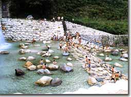
Friend Park Mukawa
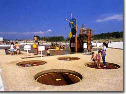 This is a park to play with river water, offers a model of river water ecological system.
Ojiranomori Meisuikouen-Beruga
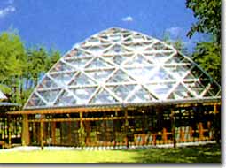 This is a discover experiencing type park near a beautiful river and forest area.
Ohumukawa Sabo Park Fugen
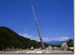 An object called Fugen in the Sabo Park looks like a monument for harmony with the nature.
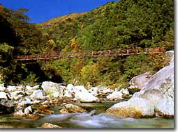
Chikuu-Komagatake Shrine
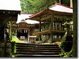 Suspension bridge behind the shrine is the start point of the Mt. Kai-Komagatake climbing route and the Ojiragawa gorge hiking course.
Yokote-Komagatake shrine/Daitakagura
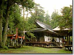 The Daitakagura which is specified as a cultural asset will be presented on April 20 every year during the festival.
Yamataka Jindaizakura
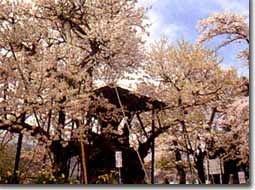 A cherry tree in a temple is specified as a natural monument by the national government. The age of the tree is said to be two thousands.
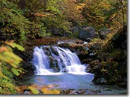
Ojiragawa gorge, Jinjyataki waterfall
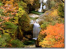 The pure white color water splashes along the 3 drops of waterfall is a beautiful scene through four seasons.
Ojiragawa gorge
 It has a beautiful white granite rocks at the riverbed. There are various natural monuments along the gorge.
Ishiutorogawa gorge, Shojigataki waterfall
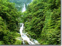 This waterfall with 121m vertical drop is called a most famous waterfall in the eastern Japan area.
Ishiutorogawa gorge
 The recommended sightseeing spots along the hiking course are the seven waterfalls and the Itoigawa-shizuoka Tectonic Line.
Daigahara shuku
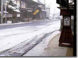 As a traditional town along the former Koshu Kaido street, there are old style scenes from the Edo period.